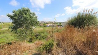
Terreno para venda em Almada, Portugal — 3 400 000 €
Terreno de 3000 m² · 1133 €/m²
- Localização
- Almada, distrito de Setúbal, Portugal
- Área do terreno
- 3000 m²
- Preço
- 3 400 000 €
- Preço por m²
- 1133 €/m²
- Tipo de terreno
- Terreno urbano
- Tempo no mercado
- 929 dias
Resumo do terreno
A classificação do solo nesta área é mista. Foram identificadas nesta área condicionantes associadas à reserva ecológica (REN) e Natura 2000. Consulte os detalhes e confirme as condições relevantes antes de tomar uma decisão.
Sobre este terreno
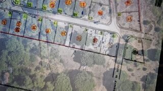
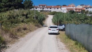
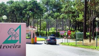
Plot of land for construction in the Aroeira condominiumTotal area of 3220sqmGross construction area of 1000sqmGated community with about 350ha near the sea that integrates two golf courses, tennis courts, hotel, shopping centre, 24h security.Inserted in a vast pine forest, the Pinhal da Aroeira, in the surroundings of this locality, to the west, are the beaches of Fonte da Telha, the beaches of Costa de Caparica and the National Forest of Medos. To the south is Herdade da Aroeira and its golf course, and to the east are the towns of Verdizela and Belverde. Herdade da Aroeira is 25km from the centre of Lisbon and only Plot of land for construction in the Aroeira condominiumTotal area of 3220sqmGross construction area of 1000sqmGated community with about 350ha near the sea that integrates two golf courses, tennis courts, hotel, shopping centre, 24h security.Inserted in a vast pine forest, the Pinhal da Aroeira, in the surroundings of this locality, to the west, are the beaches of Fonte da Telha, the beaches of Costa de Caparica and the National Forest of Medos. To the south is Herdade da Aroeira and its golf course, and to the east are the towns of Verdizela and Belverde. Herdade da Aroeira is 25km from the centre of Lisbon and only 600 meters from the beach, and is the largest residential and golf complex in Greater Lisbon. Energy Rating: Exempt #ref:PAR_951
Comodidades próximas
Distâncias aproximadas com base no centro da área
Explore dados adicionais do terreno
Abra no Yonder para verificar os dados disponíveis
- Restrições (REN, RAN, Natura 2000)
- •••
- Uso do solo
- •••
- Elevação
- •••