Land for sale in Arruda dos Vinhos, Portugal — €15,000
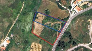
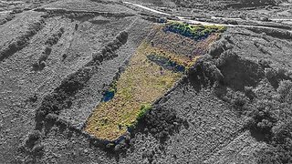
8,360 m² plot · €2/m²
- Location
- Arruda dos Vinhos, Portugal
- Plot size
- 8,360 m²
- Price
- €15,000
- Price per m²
- €2/m²
- Listing type
- Rural plot
- Time on market
- 345 days
Land overview
Land classification in this area is mixed. Explore the details to better understand this land classification and confirm the relevant considerations before making a decision or planning your next steps.
About this land
Original listing description, in Portuguese.
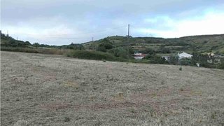
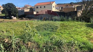
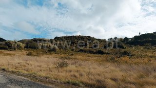
Terreno Rústico com 8.360m2- Carvalhinho Este Terreno fica localizado numa zona do Carvalhinho, conhecida localmente como Carvalha. A propriedade beneficia de acessos fáceis e de uma envolvente tranquila, com privacidade e uma boa exposição solar. É um terreno adequado para uso agrícola, pequeno cultivo ou atividades relacionadas com o campo, oferecendo espaço e versatilidade numa zona próxima do centro de Arruda dos Vinhos NOTA: Não é permitida construção. Rustic Land with 8,360 m² – Carvalhinho This plot of land is located in the Carvalhinho area, locally known as Carvalha. The property benefits from easy access and a peaceful surrounding environment, offering privacy and good sun exposure. It is suitable for agricultural use, small-scale cultivation or other countryside-related activities, providing space and versatility in an area close to the centre of Arruda dos Vinhos. NOTE: Construction is not permitted. Terrain rustique de 8 360 m² – Carvalhinho Ce terrain est situé dans la zone de Carvalhinho, connue localement sous le nom de Carvalha. La propriété bénéficie d’un accès facile et d’un environnement paisible, offrant intimité et une bonne exposition au soleil. Il s’agit d’un terrain adapté à un usage agricole, à la petite culture ou à d’autres activités liées à la vie rurale, offrant espace et polyvalence dans une zone située à proximité du centre d’Arruda dos Vinhos. REMARQUE : La construction n’est pas autorisée. ;ID RE/MAX: 123221068-174
Nearby Amenities
Approximate distances based on area centroid
Explore additional land data
Open in Yonder to check available data
- Restrictions (REN, RAN, Natura 2000)
- •••
- Land use
- •••
- Elevation
- •••